Satellite Intelligence to Stay Ahead of Change
We transform massive amounts of Earth observation data into actionable intelligence for timely decision making.
Our Partners
Exploit your SAR data
We leverage commercial and public satellite data, focusing on synthetic aperture radar (SAR) sensors that can acquire images day-and-night and through clouds.
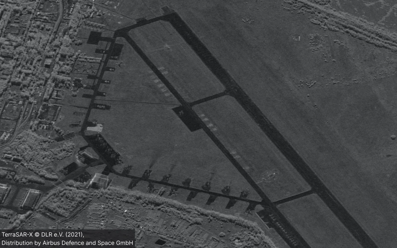
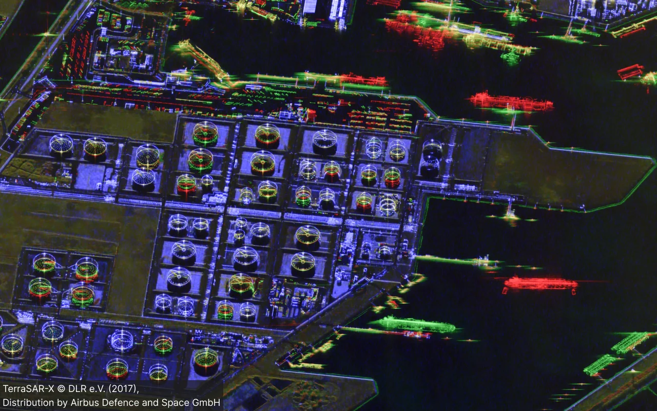
Visual Image Analysis
Using advanced image processing algorithms from our partners, we transform raw visual data into intuitive image products for quickly extracting critical insights.
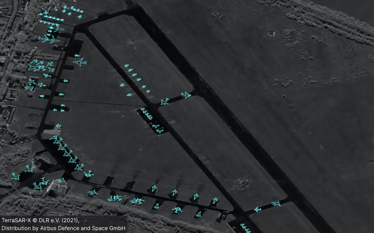
Automatic Insights
We automate image analysis by turning large amounts of visual data into actionable intelligence for security applications like target recognition, infrastructure monitoring, etc.
Unlock the Future of Imagery Intelligence - Book your Demo Today
Our Product
Born from over two decades of research at the German Aerospace Center (DLR), RADIAN began as a ground-breaking image processing toolkit. TerraLens was founded as a spin-off to transform this powerful tool into a smarter, faster solution for imagery intelligence, delivering actionable insights with unparalleled efficiency.
Data Sovereignty
Data Diversity
Easy-to-use
Performance
Use Cases
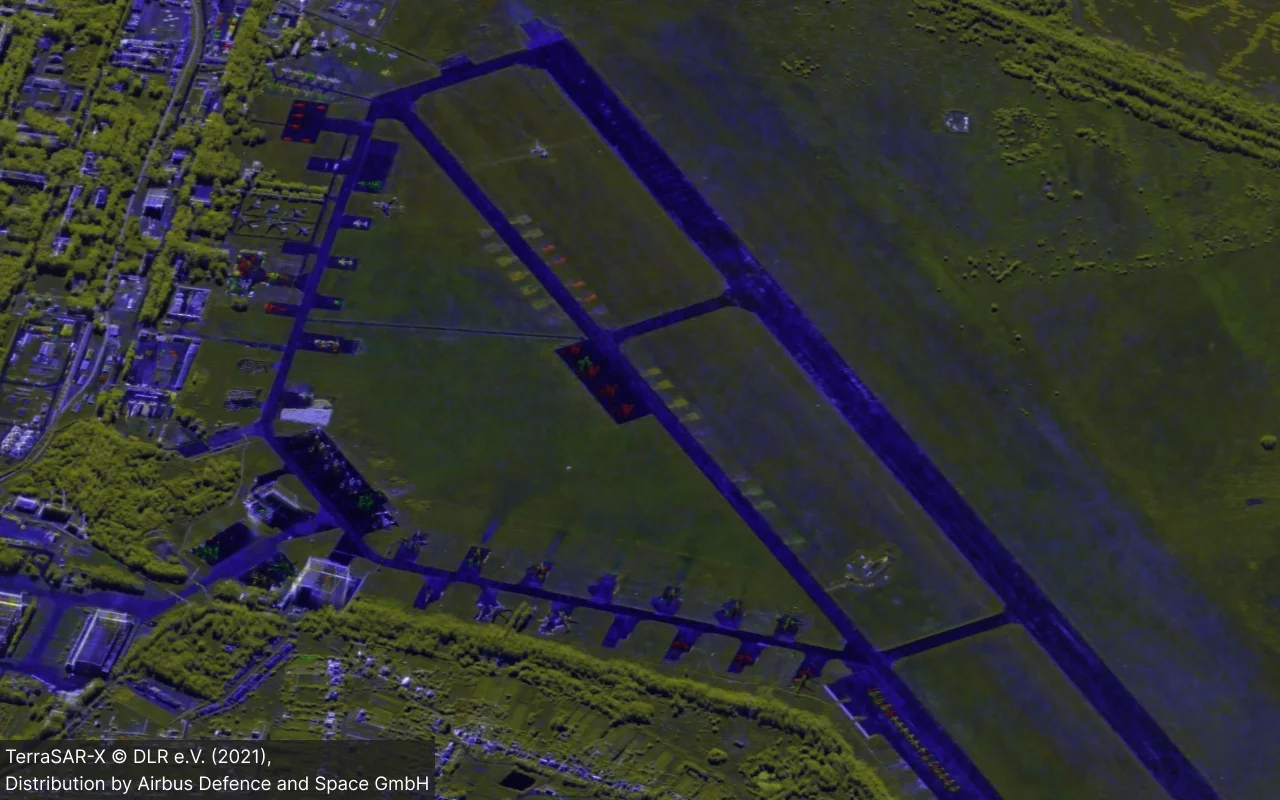
Visual Change Detection
A SAR satellite mission with a repeat orbit has unique capabilities beyond its all-weather, day-and-night operability. It can also robustly detect changes on the ground by comparing images taken at different times.
Our change detection products simplify the process of identifying these changes. By using a color-coded system, you can easily interpret the differences between image pairs:
🟥 Appeared
🟩 Disappeared
🟦 Stationary
🟨 Small displacement
Automatic Construction Monitoring
Visual change detection products for urban areas can be overwhelming. They often show a multitude of changes from various sources like traffic, construction or vegetation, making it difficult to get a clear, overall picture of the situation.
Our fully automated monitoring solution solves this by specifically detecting construction sites. This process requires long-term time series acquisitions to identify and track the construction or demolition of buildings or infrastructure.

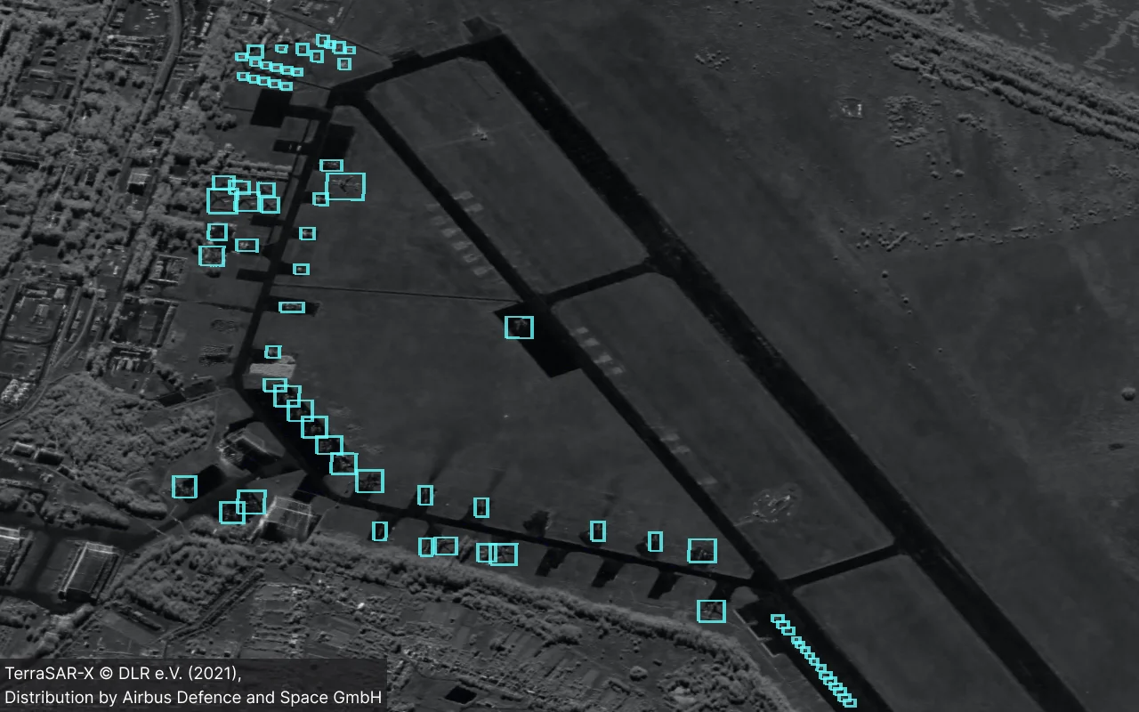
Automatic Target Recognition
Visual recognition of objects in SAR imagery is challenging due to radar specific imaging effects (e.g., speckle noise, multi-bounce reflections…).
Our automatic target recognition (ATR) solution is an advanced, AI-based system designed to simplify this process. It provides an end-to-end workflow, enabling customers to:
- Label their own data for training.
- Augment their training dataset with simulated signatures.
- Train and fine-tune classifiers to their specific needs.
- Automatically perform object recognition on new data.
Product Roadmap
We are committed to building the future of SAR imagery intelligence. Together with our partner DLR, we bring the best of research and innovation directly to your operations.
RADIAN Desktop
The Radar Image Analysis Toolkit is a Desktop application for visual data analysis, powered by innovative image processing algorithms from DLR.
RADIAN Server
The Radar Image Processing Server automates and boosts your image production. It runs on powerful GPUs and can be triggered flexibly over an API.
Monitoring Services
Our monitoring services will automatically transform your data into meaningful insights. You do not have to care about image production or analysis anymore.
About TerraLens
TerraLens is a spin-off from the German Aerospace Center (DLR). Founded in 2022, our company brings promising and innovative results from DLR’s research into professional software solutions for security-relevant applications using Earth observation data.
We fill the gap between scientific prototyping and operational requirements by implementing state-of-the-art algorithms into custom-made and on-premise solutions to support political and strategic decision making.
Years of experience